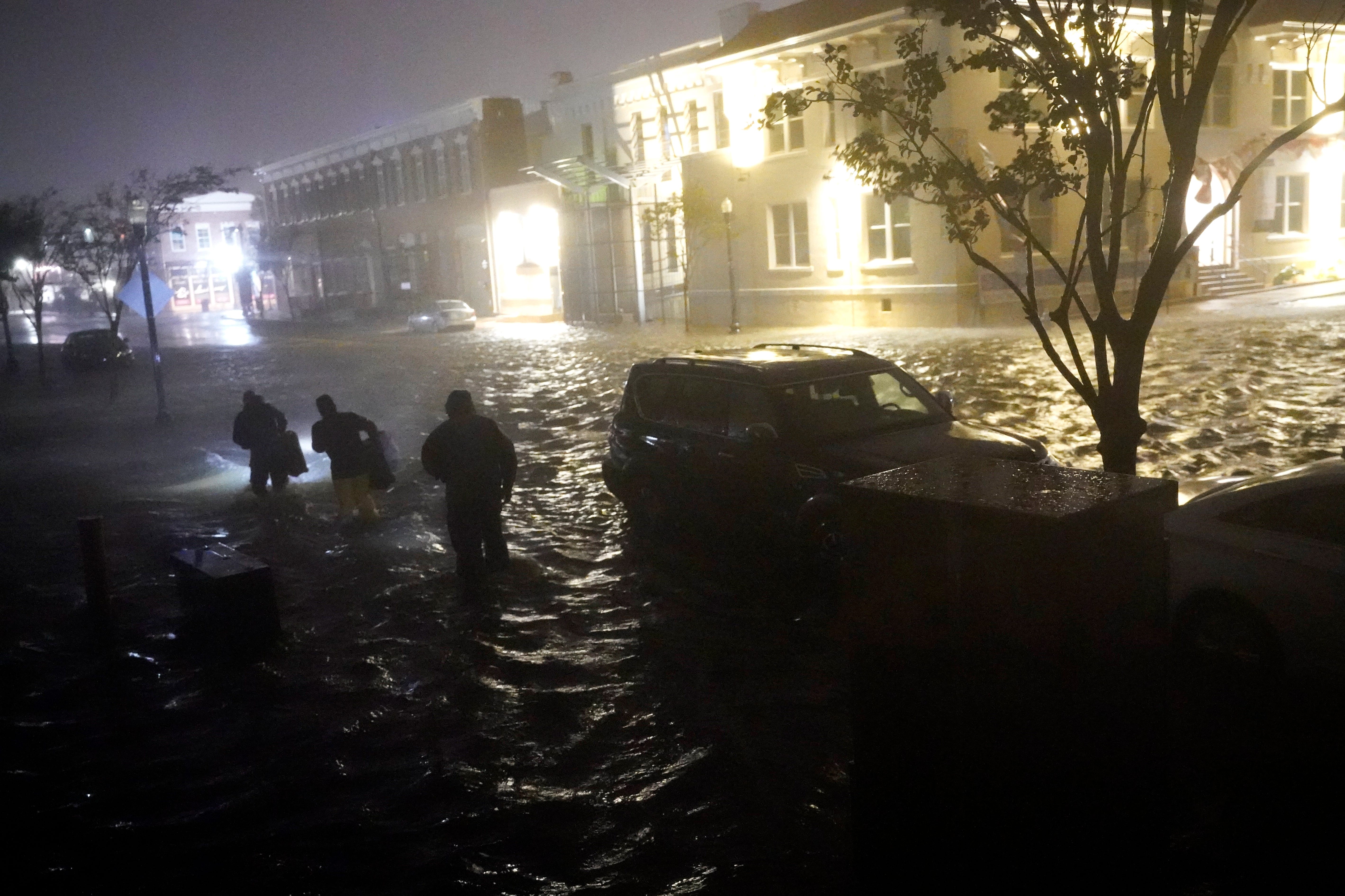
Hurricane Sally lurched ashore early Wednesday after intensifying overnight to a Category 2 storm, promising to soak the Gulf Coast and Southeast with heavy rains and historic flooding.
Sally's strong winds are battering Pensacola, Florida, and the storm's slow pace means the rains will bring "catastrophic and life-threatening flooding," forecasters say.
The hurricane made landfall at 4:45 a.m. local time with winds of 105 mph, the National Hurricane Center said. Sally is continuing to crawl north-northeast at 3 mph, and the storm's center will move across southeastern Alabama and the Florida Panhandle through early Thursday.
Hurricane-force winds extended out from the storm's center up to 40 miles, the hurricane center said, and as Sally moves inland it will weaken.
Still, with heavy rainfall lashing Alabama and Florida, "historic and catastrophic flooding is unfolding," the hurricane center said Wednesday morning. "In addition, this rainfall will lead to widespread moderate to major river flooding."
Some other major developments:
- Sally is forecast to head inland Wednesday night across southeastern Alabama before reaching Georgia on Thursday and the Carolinas on Friday.
- Around 10 to 20 inches of rain could be dumped on parts of Alabama and Florida, with isolated pockets getting up to 35 inches.
- Sally is the eighth named storm to make landfall in the continental U.S. this year — the most through Sept. 16 in recorded history.
- More than 400,000 homes and businesses are without power, according to the utility tracker poweroutage.us.
Here's a look at the latest news with Hurricane Sally:
Alabama: Rescues underway, heavy damage to homes, businesses
Rescue crews are working to pull people from their homes damaged by Hurricane Sally and in the midst of massive flooding, Senior Forecaster David Eversole with the National Weather Service in Mobile said.
"There's two flash flood emergencies currently in affect for coastal Baldwin over to Fort Walton Beach," he said.
Eversole said he's gotten reports of damage to several condos in the Gulf Shores area, as well as damage to the Surf Shop and Pink Pony Pub. Debris in Orange Beach sloshed against some condos as a boat floated its way between some of the buildings.
"We know people are being rescued and we know there is severe property damage," he said.
– Kirsten Fiscus, Montgomery Advertiser | 8:10 a.m. CT
Hurricane Sally has eerie similarities to Ivan – 16 years later
Sally’s path and landfall is eerily similar to Hurricane Ivan’s, which made landfall on the same day – Sept. 16 – in 2004, 16 years ago, in nearly the exact same place that Sally is projected to land. Ivan was a stronger Category 3 storm and devastated the area.
– Annie Blanks, Pensacola News Journal | 8 a.m. CT
Flora-Bama beach bar survives Hurricane Sally
Not even wet and windy Hurricane Sally was able to blow away the Flora-Bama. The "most famous beach bar in the country" is still standing, according to a photo and caption the United Cajun Navy posted Wednesday morning at 5:23 a.m. CT. The volunteer rescue group is currently hosting relief efforts in Escambia County.
The photo shows no visible damage to its roof or its walls, but shows rising water surrounding the landmark bar on the border of Alabama and Florida.
– Daniella Medina, Pensacola News Journal | 8 a.m. CT
Rescue workers called upon amid flooding in Okaloosa County, Fla.
Okaloosa County rescue workers were called upon early Wednesday as Sally created flooding that required emergency evacuations in some areas.
"We are receiving reports of flooded roadways and homes and are actively engaged in water rescues and evacuations," Okaloosa Public Safety Director Patrick Maddox said in a 4 a.m. update to county officials.
County spokesman Christopher Saul said 543 people in the south end of Okaloosa County were "in need of evacuation" as of about 5:30 a.m. Rescue workers had succeeded in helping 79 people evacuate from the Baker area, he said.
– Tom McLaughlin, Northwest Florida Daily News | 7:30 a.m. CT
Hurricane Sally dumps 30 inches of rain on Pensacola
The National Weather Service in Mobile reported a trained spotter estimated 30 inches of rain in Northwest Pensacola. NAS Pensacola recorded 24.8 inches of rain and wind gusts up to 92 miles per hour.
Earlier Wednesday, the Weather Service issued a "rare" flash flood emergency warning.
"It’s when we have a flash flood that is posing a significant risk to lives and property,” said Dave Eversole, a meteorologist with the National Weather Service in Mobile, Alabama. “That means there’s people out there literally pulling people out of homes and rescuing people out of cars. It’s right along with a tornado emergency, it’s one of our two most serious warnings.”
Interstate 10, eastbound and westbound, at the Escambia Bay Bridge is also closed due to high sustained winds.
– Annie Blanks, Pensacola News Journal | 7:30 a.m. CT
Weather Channel's Jim Cantore in Pensacola
Jim Cantore, the famed Weather Channel weatherman, was in Pensacola early Wednesday to track the storm. Cantore is notorious for reporting from some of the worst weather situations in the country.
He tweeted video of powerful winds tearing through the city Wednesday morning and shots from the Weather Channel showed him being battered by the heavy rain.
– Annie Blanks, Pensacola News Journal | 6:30 a.m. CT
Sally is 8th named storm to make landfall this year
Sally is the eighth named storm to make landfall in the continental U.S. this year — the most through Sept. 16 in recorded history, surpassing the seven storms of 1916, according to Phil Klotzbach, a research scientist and meteorologist at Colorado State University.
The record for most continental U.S. landfalls in a single Atlantic season is nine, also set in 1916. The center of Sally's eye made landfall around 4:45 a.m. local time near near Gulf Shores, Alabama.
– John Bacon, USA TODAY | 4:45 a.m. CT
Tracking Sally: Here's the latest on hurricane's path
from GANNETT Syndication Service https://ift.tt/32CAngq
Post a Comment
Post a Comment